Smart Campus Navigation
Research and development of a prototype for AR-based indoor and outdoor navigation on the Bildungscampus
Duration: March 2020 – July 2020

© Fraunhofer IAO, verändert nach Roland Halbe und Fotolia – Ovsianka
Contact person

Maximilian Feike
E-Mail: maximilian.feike [at] iao.fraunhofer.de
Phone: +49 711 970-5265
The Bildungscampus in Heilbronn is a complex organism with 10 educational and research institutions so far. It is not always easy for visitors, students and staff to find their way around the large campus area. The existing signage does point to institutions, buildings and rooms. Finding the nearest snack machine, locker, workstation or printer, on the other hand, is more difficult. In this case, the Campus Navigator, which is being developed as part of the Smart Campus Initiative, can make it easier to find them.
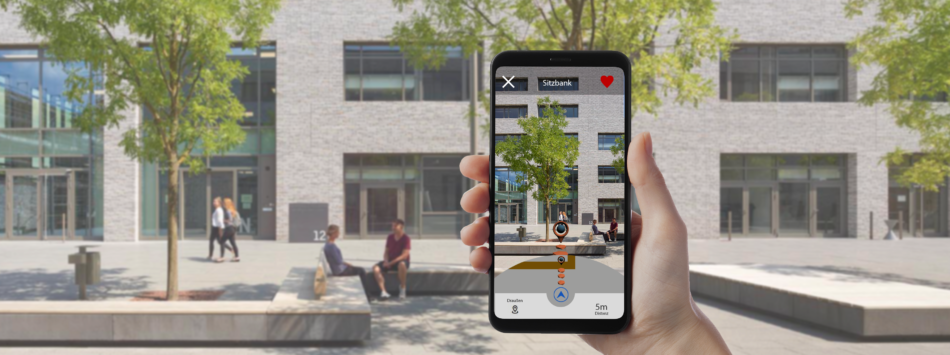
In the project, scientists from the Research and Innovation Center Cognitive Service Systems (KODIS) of Fraunhofer IAO are working together with software experts from CAMAO on a camera-based augmented reality (AR) solution for indoor and outdoor navigation. The aim is to develop a prototype for a smartphone application that reliably guides users around the Bildungscampus.
The research interest lies in particular in testing the technical feasibility of a novel camera-based positioning method. The game engine Unity3D for the display and interaction of 2D and 3D content and Azure Spatial Anchors from Microsoft are used as key technologies. Azure Spatial Anchors enables the creation, retrieval and storage of optical anchor points and uses the AR functionalities of smartphones (AR Core – Android, AR Kit – iOS) to generate point clouds. The application recognises where the users are via camera matching. The advantage of this positioning method is that it is purely camera- and internet-based and therefore does not require the installation of additional stationary hardware on campus. In contrast to conventional GPS-supported navigation applications, this also enables indoor routing.
The project includes the conception and development of a navigation app – the Campus Navigator – as well as an administration app, a backend and a browser-based analysis tool. The initial focus of the implementation is on navigation in the entire outdoor area of the Bildungscampus, as well as navigation to and in the auditorium, library and refectory. In the long term, the aim is to include the other campus buildings in the application step by step after the prototype development and test phase have been completed and to make the Campus Navigator available to students, staff and visitors.
The integration of the Campus Navigator into a campus app is conceivable. Furthermore, it is possible to enrich the navigation points (points of interest – pins) with additional information such as the cafeteria schedule, event flyers, links to websites of campus institutions or explanatory videos. Pins are currently managed via a separate administration app, but in the long-term users could be involved in the administration and enter their own pins. As an expanding element, an AR campus tour could be offered for new students and visitors.
Applications based on AR technologies have so far been known especially from the gaming or interior design sector (e.g., Pokémon GO, Minecraft Earth or IKEA Place). In combination with a navigation function, they offer real added value and can help to find different target points. Thus, the described solution could be transferred to other university and company campuses, administrative buildings, hospitals, shopping centres, trade fair grounds or airports. Even the use in supermarkets for direct navigation to the desired product would be conceivable.
Other fields of application
university and corporate campuses
administration buildings
hospitals
shopping centres
exhibition halls
warehouses
airports
amusement parks
libraries
supermarkets
